From Cajamarca we headed south, aiming for Huaraz, all through the cordillera (high mountains), on a series of roads and routes of varying surfaces and degrees of adventure:

check out the pig

this first section is paved (photo: Arnaud de L.)

... election propaganda in Peru. To vote, you mark the picture of the party you want, for example, wheat (above), or tower (below). There are many other options as well, ranging from apples to sombreros to trees... (photos by Arnaud de Laveleye)


great paved descent (photo: Arnaud de L.)


... scenes from market day in Cajabamba...


mototaxi stand in Cajabamba (photo: Arnaud de L.)

local dwelling on outskirts of Cajabamba

roof tile factory -roadside- between Cajabamba and Huamachuco (photo: Arnaud de L.)

growing wheat (photo: Arnaud de L.)

the scene on the way to Huamachuco (photos: Arnaud de L.)


Laguna Sausacocha near Huamachuco, famous for its trout fishery (photo: Arnaud de L.)
Just after Huamachuco, we began an epic dirt-road adventure that would take us nearly to Caraz in the White Mountains. The first segment began by heading towards the San Simón gold mine.

cemetary near the San Simón gold mine (photo: Arnaud de L.)

little traffic, aside from the dust-hurling trucks passing now and then (photo: Arnaud de L.)

long climb between the gold mines of San Simón and Comarsa (photo: Arnaud de L.)

vicuña at the high point at 4000m (photo: Arnaud de L.)

watch out for vicuñas and humans (photo: Arnaud de L.)

descending towards Comarsa (photo: Arnaud de L.)

the massive Peruvian-owned Comarsa gold mine (photos: Arnaud de L.)


(photo: Arnaud de L.)

amazing backcountry roads

the small remote town of Tulpo

between Tulpo and Mollepata, great mountain-and-canyon landscapes...

... and campesino lifestyle...

Mollepata perched high above the Tablachaca River canyon (photo: Arnaud de L.)


Sonja chatting with a friendly local woman in Mollepata

Mollepata houses a fantastic pre-Incan mummy collection. This one even has an erection (photo: Arnaud de L.)

... the beyond-words, hair-raising descent from Mollepata down into the Tablachaca River canyon.

the crazy almost-illogical road that climbs out of the Tablachaca canyon towards Pallasca 1500m above. Luckily, we averted this climb by finding an old road that parallels the Tablachaca River, descending softly on this fantastic no-traffic road that no one seems to know about... we heard of it from a local truck driver near the San Simón mine.

this was to be a dream road: no traffic, varying surfaces, insane scenery, fun riding, high adventure. (photo: Arnaud de L.)


(photo: Arnaud de L.)

... there was only one catch: two river fords. Which probably scares most cyclists away. However, we found the water level low enough to make them easy crossings... (photos: Arnaud de L.)

the first crossing


the second crossing. this time on a narrow bridge constructed by local gold panners. (photo: Arnaud de L.)

gold panners' seasonal homes along the river

...continuing downstream, the canyon became even larger and more spectacular...


In the end, we decided that this (Tablachaca River Road) was our FAVORITE ROAD EVER. No small feat, all things considered. (photo: Arnaud de L.)

... seemingly never-ending heaven-like cruising...

(photo: Arnaud de L.)

after 60km or so, it turned to pavement, on the way towards searing-hot Chuquicara at only 600m above sea level
(photo: Arnaud de L.)

... after Chuquicara, we started up another long, dry canyon... this would be a gradual climb of some 90km or so... (photo: Arnaud de L.)

... now in the Cañon del Pato, famous for its 25-plus tunnels in only 13km... (photos: Arnaud de L.)

cycling through the longer of these tunnels, the scene was truly surreal: thick gravel road, loose surface, complete darkness, too much bouncing around to make a headlamp useful, narrow lanes, and uphill all the while. Hoping a big truck or a fast vehicle didn't coincide at the same time as us in the tunnel.

the road turned to pavement before Caraz, just after the Cañon del Pato. Having begun in Chuquicara, this climb was to be about 2500m in total, until Huaraz at 3090m.
(photo: Arnaud de L.)

now in Huaraz, view of Huascarán, highest mountain in Perú at 6768m. From Huaraz on a clear day you can see a large spread of the Cordillera Blanca.

found in the Huaraz market, these are beet/carrot drinks that we found for 3 soles a jar, or just over a dollar. We drank MANY of these in Huaraz, replacing lost vitamins from so much climbing and sweating.

at Hostel El Tambo in Huaraz, we had a few jam sessions

dinner party at El Tambo with some friends from Argentina, Catalonia, and Switzerland

Daniel, an Israeli magician, showing Jason some tricks

gory scenes from the Huaraz market. Goats' heads.
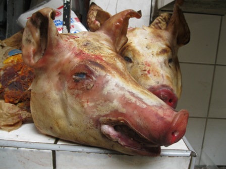
severed pigs' heads, Cuba-like in their grimness

the best of all, skinned and gutted guinea pigs (CUY), one of Peru's main culinary delights, supposedly.

In Huaraz, we busked again for the first time since Quito, several months ago. These sessions were quite animated and productive. (this and following 8 photos: Patrick Meury)

getting warmed up

Craig belts one out, Sonja on maracas

blues licks fill the air

Jason on rhythm

our fan club

joined by a young local guitarist who sits in on a few songs

one of the several large crowds we were able to gather in Huaraz
(photos this post Craig Caparatta unless otherwise noted)