El Calafate is on the tourist map for one reason: it is the nearest place from which to visit the Perito Moreno Glacier, one of Argentina's, and Patagonia's, most famous attractions. However, as it is 80km west of El Calafate (far off our route), into a backbreaking and unpitying headwind, we decided to rest our bikes in El Calafate and hitch out to the glacier.

sometimes the Argentina precordillera seems more like Arizona country (on our way to the glacier)

Perito Moreno Glacier from a distance (photo: Greg Altman)

as you can see, this glacier comes roaring out of the Southern Patagonia Icefield and ends abruptly at Lago Argentino (photo: Greg Altman)

Parque Nacional Los Glaciares, which includes the Perito Moreno Glacier, has built a multi-level viewing platform for visitors. Doesn't justify the 100 peso/25 dollar (per day) entrance fee, though.

If you station yourself here for awhile, like an hour or two, with any luck you will see huge portions of the glacier front come crashing off into the lake, immediately forming icebergs (photo: Greg Altman). The glacier wall where it meets the lake averages 74m (240ft.) in height.

we watched the glacier for over 3 hours...

... as it would move from moments of inactivity into brief flashes of noise and stunning collapses with creaks and groans, breaks, and sometimes echoing explosions (photo: Greg Altman)

(photo:Cat Magill)

a parting look at the glacier (photo: Greg Altman). It is over 5 km (3 miles plus) wide.

Above: Old El Calafate. A small village which tied together various estancias, all dedicated to sheep ranching, and which would have featured characters like the one above.
Below: New El Calafate. A sprawling, poorly-planned, quickly-growing mass tourism spot with little soul. To make matters worse, horrible subdivisions popping up along Lago Argentino...


El Calafate seen while riding away
A handful of kms from El Calafate, we came across this fascinating shrine to San La Muerte, yet another Argentine pagan saint (from the northeastern provinces of the country). Its resemblance to the Mexican Santa Muerte is striking, although the Argentine version is a male skeleton, while the Mexican is female.

San la Muerte (photo:Cat Magill). Apparently, San la Muerte can interact for his followers during crises of love, health, and fortune, and can protect them from witchcraft.

"Thanks, San La Muerte". This shrine was erected by an Argentine from the northeastern part of the country who has moved to El Calafate following employment and higher wages. We would see this trend in various parts of Patagonian Argentina: the pronounced southern migration of northerners.

the cordillera rises dramatically behind Lago Argentino

Jeff in late afternoon light, striking out across the pampa (Patagonia's - and Argentina's - most extensive ecosystem by far... large, mostly-uninhabited expanses of flattish lands covered by desert scrub, all of this very arid and on an enormous scale)

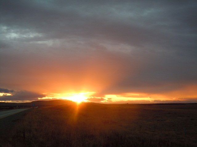
the pampa does provide some amazing sunsets, though

camped out in a culvert (only protection from wind and rain), as there are no trees or breaks in the landscape anywhere.

curious severed and discarded hoof near culvert

most of the Argentine precordillera looks like this, or some variant of this

a small herd of guanaco spread out along a hillock

after the physically-strenuous Carretera Austral of Chile, the Argentine pampa is easy fare, as long as the wind is at your back!

Cat with the caretaker of an Argentina highway depot at El Cerrito (used mostly in wintertime as a base from which to clear heavy snowfall from highways). We stopped here to drink some mates and eat a late breakfast before heading on.

on the trail of guanaco as we head out on a dirt road from El Cerrito

at first this ride seemed great (no traffic, open landscapes), until we found ourselves in a bloody battle with a nasty headwind on a loose gravel road for nearly 75 km. It took us between 7 and 8 hours to move 50km. (photo:Cat Magill)

the scene at dawn was amazing out here

we moved south paralleling this range to the west, heading towards Tapi Aike and eventually Rio Turbio (photo:Cat Magill)

this is what headwind does to cyclists (photo:Cat Magill)


lots of coal mining at Rio Turbio (photo:Cat Magill)

Flamingoes at the entrance to Rio Turbio, pretty much across the highway from the above mine. We also saw some condors here.

sighting back at Rio Turbio

the top of this tree is covered by Austral Parakeets

heading back into Chile (again) near Rio Turbio

this fellow tried to get in on our adventure, voluntarily following us after Rio Turbio, only to be detained by Chile's border police, much to our relief.

The difference on the Chilean side is notable... actual lived-in estancias and houses are peppered along the highway, unlike the Argentine side.

herds of sheep spotted on the way to Puerto Natales

one of the largest shrines to Difunta Correa we have seen, curiously enough near Puerto Natales (Chile). Evidence of the spread of the cult from Argentina into Chile.

Now in Puerto Natales, these are Imperial Cormorants atop the old pier. (photo:Cat Magill)

our lodging for the night was provided by Rodrigo, a craftsman and gem trader who runs a cafe in Puerto Natales.

"No Dams in Magallanes!" (Magallanes is Chile's Twelfth Region). As in the neighboring region of Aysen, the locals have struck up a heated resistance to big dam building in Chilean Patagonia.

"Mega Dams: An Obsolete Technology". From a book seen at Rodrigo's. For more information and to join the battle against HydroAysen, see www.patagoniasinrepresas.cl

Rodrigo and Jeff in front of Rodrigo's cafe

leaving Puerto Natales, we passed by this likeness of a Milodon, a prehistoric giant whose bones were found in a cave some 24km away. (Note: Puerto Natales is also the jumpoff point for Torres Del Paine National Park, which offers lots of trekking and great scenery. However, we opted not to visit on this trip, as the season is LATE, the days are getting shorter, and Ushuaia is still about 1000km away)

looking back on Puerto Natales with a rainbow behind it

the route we would follow between Puerto Natales and Punta Arenas, nearing the end of the continent of South America! (photo: Greg Altman)

Spectacled Duck (threatened species) seen cycling south of Puerto Natales.

Cat, now in Chilean pampa, with some scattered trees and forest

this tree is proof of the dominant wind direction in these parts
...another unforgettable pampa sunset...


In late March in southern Patagonia the nights are COLD, as the very short autumn gives way to winter. We camped a few nights in this stretch and beat back the cold with campfires.

dawn

packing up camp among sparse open forest

as we moved south, things reverted to Argentina-like in their vast desolation

the cornerstone of Patagonian existence before tourism

a day's ride out of Punta Arenas we ran into Tom and Sarah, a British/Australian couple who have cycled south from Canada over the past 20 months. As coincidence would have it, they met and cycled with our friend Anna Kortschak in Costa Rica in 2011.

Tom has ridden the whole way with an X-tra Cycle. Sarah, on the other hand, had the misfortune of having her bicycle stolen on the streets of Mendoza a few months ago, and she was forced to buy a new bike to be able to continue riding.

somewhat visible (photo, left of center) is a Rhea, an ostrich-like bird found in the Patagonian pampas. We usually see them in small groups, but this one was spotted on its own. Easily spooked, constantly in motion, and notoriously difficult to photograph.

riding now as four, as we near Punta Arenas

... a few more shots of guanacos, fairly numerous in these parts...


the four of us found refuge from the cold and wind in this building

center: Chilean flag. right: flag of Magallanes (Twelfth Region), which shows the Southern Cross.

these are fairly common in Magallanes: dilapidated boats in random places

We DID attempt to visit this penguin colony (Magellan Penguins) about 25km north of Punta Arenas, but it had been shut down for the season, as the penguins all migrate to Brazil (!) from April to September.

Punta Arenas

Punta Arenas has an interesting energy: end-of-the-world but gritty, blue collar, a very real port city, with plenty of dilapidated houses and seedy establishments (photo: Cat Magill)

another look at Punta Arenas (photo: Cat Magill), which is situated on the west side of the Straits of Magellan, and is only about 50km north of the remote southern tip of the South American landmass.

street art in Punta Arenas

in Punta Arenas we found a seafood stew, loaded with mussels and clams and squid. Furthest to the right, Patagonian King Crab.